The Flat Earth map Does not Match with Real Measuremnts Facts
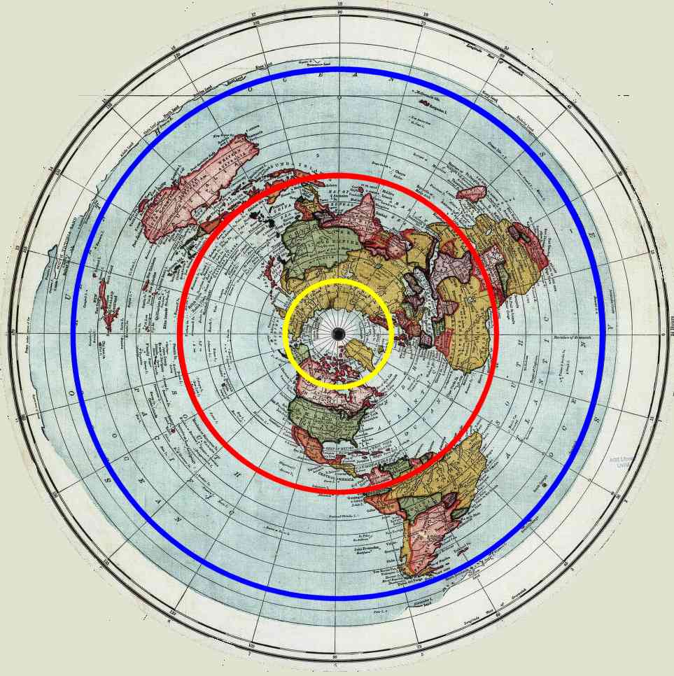
Discussion The traditional flat earth map has to deal with the fact that day and night occur due to the movement of the sun. This is explained by proposing that the sun rotates around the north pole, with eccenticities to account for seasonal variation. It could equally have been explained by having the sun revolve around the south pole, but for the following reasons the flat earth map has had the centre of the sun's rotation as the north pole, .
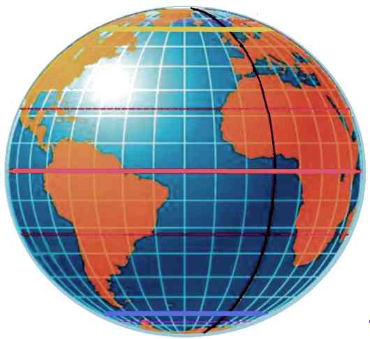
This means that the flat earth map has to look something like this: 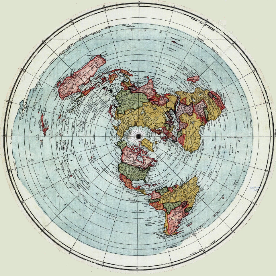 If we look at the latitudes and compare with the globe, a stiking difference becomes visible
Flat earth maps essentially never have measurements on them, presumeably because it quickly becomes apparent that the flat earth model can quickly be disproven once measurements are attached. Given that the equator is 10,000km away from the north pole, the following approximate measurements can be deduced from simple trigonometry (ignoring the fact that the earth is not a perfect sphere). Also note that the same discrepencies occure regardless of what measurement is taken for the distance from the north pole to the equator.
The red figures demonstrate the glaring differences between the two models. This is readily testable. However, those who believe in a flat earth deny that there is a south pole and will not accept any records that demonstrate anyone going there. In December 2024, a party went to Antarctica in what was called "The Final Experiment". Four of the people were ardent believers in a flat earth. They observed the summer sun not setting and hence not providing night. This could not be explained by a flat earth model. They publicly declared their mistake. Other flat earthers declared that the expedition was fake and part of a conspiracy to hide the truth. Details can be found here. However, there are other ways of demonstrating the discrepency. 1) Predicted land measurements are wrong The flat earth model is approximately corrrect for the Northern hemisphere but is incorrect for determining distances in an east to west direction south of the equator. This is most evident in Australia, which is the broadest continent south of the equator other tha Antarctica.
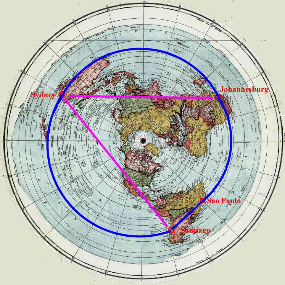
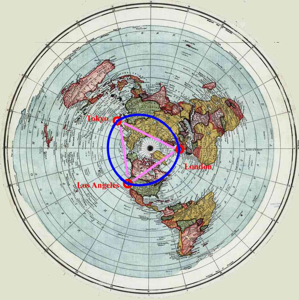
The difference in longitude between Perth and Sydney is 35.35 degrees. The difference between Adelaide and Sydney is 12.61 degrees. Sydney is 13,760km from the North Pole and as such, from the flat earth map, is on a circumference of the earth 86,457km around. 35.35 degrees is nearly a tenth of this circle and hence, from the flat earth map, is calulated to be 8,450km from Sydney. The reality is that Perth is 3,280km from Sydney as the crow flies. It is 3,846km by road. The author has driven between Sydney and Adelaide many times in the past. It used to be about 1,500km and took about 17 to 19 hours of driving time. It is a little shorter now due to road changes. Google Earth says it is now 1,375km and takes 14.5 to 16 hours to drive. It also says that it is 1,166km in a direct line. On the map, the two cities are 12.61 degrees apart. On a flat earth map, this represents 12.61/360 * 86,457km = 3,028km. 2) Commercial air services demonstrate that flights across similar latitudes in the north and south hemispheres are similar.
The conclusion here is that there is no sigificant difference in flight times despite the southern distance being three times longer. Looking at the maps below, one can easily see that on a flat earth model, the southern route is much longer and should take three times the time to fly. This is clearly not the case and is good evidence that the flat earth model is wrong.
3) There is a yacht race around Antarctica It runs from Albany in Western Australia and is called the Antarctic Cup. The course is about 14,000 to 16,000 nautical miles (25,928 to 29,632km). The record holder is Lisa Blair who single-handedly completed the course in just over 92 days. According to a flat earth map, the circumference of the world at 40deg south should be 90,823km and at 60 deg south it should be 104,797km. At about 100,000km this is a considerably at odds with the stated course length of about 27,000km. Links are here and here. Return to homepage |