|
Any star could be used, but for simplicity, the star Polaris is used because it stands directly above the north pole. The Northern Celestial Pole is marked by the star Polaris. This means that it is almost exactly overhead at the north pole. Knowing this, enables anyone in the northern hemisphere to determine their latitude by measuring the altitude (angle above the true horizon) of Polaris from their observation point. On a flat earth model, knowing this angle and the distance to the north pole, enables you to calculate how far above the north pole Polaris is. Polaris has an altitude of 29 degrees at New Orleans, Louisiana. New Orleans is 6,676km away from the north pole. This is illustrated in the diagram below. The height of Polaris divided by the distance to the north pole must equal tan 29 deg. So the height becomes 6,767 x tan 29 which equals 1,959km above the north pole. Repeating the calculation for San Salvador in El Salvador predicts a height of 3,701km. Clearly Polaris cannot be in both places at the same time. This means that the flat earth model is wrong. 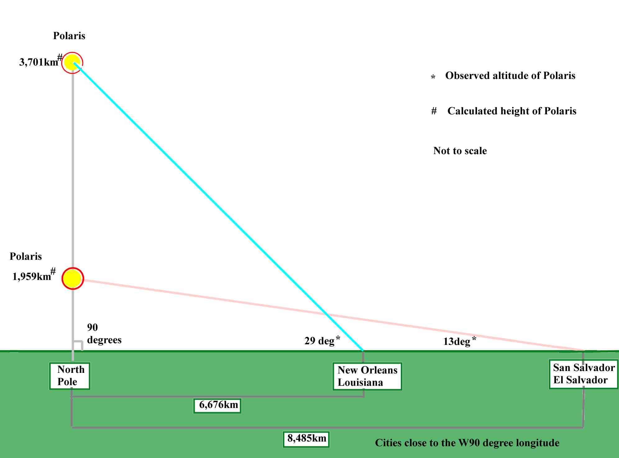
On the other hand, these observations, whenn mapped on a spherical earth model, show that they accurately predict the position of Polaris. 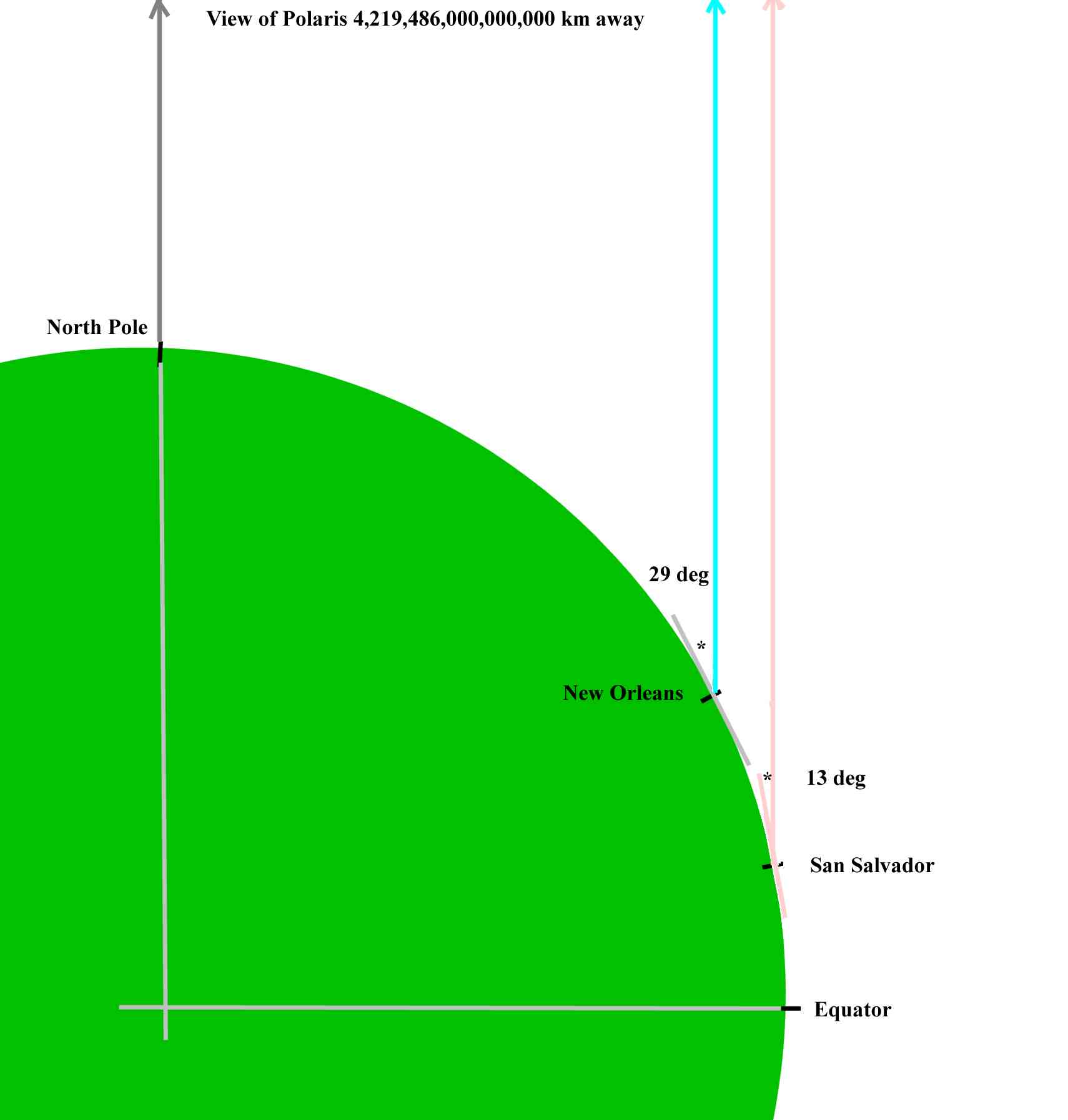
Return to home page |